
Geography fieldwork incursion | Stage 6 Geography
Program overview
Geography fieldwork is a Stage 6 Geography incursion where students investigate an ecosystem at or near their school using geographical inquiry and specialised fieldwork equipment. Working in groups, students apply ecological sampling techniques and measure abiotic factors to collect qualitative and quantitative data about local environmental conditions.
Students compare sampling methods, interpret relationships between living things and environmental factors, and evaluate the validity and usefulness of their data. The two-hour program contributes to mandatory Year 11 fieldwork and supports Earth’s natural systems and the Geographical Investigation. Access to a significant natural area or nearby reserve provides the richest learning experience.
This fieldwork incursion is also available for Stage 6 Science.
Fieldwork inquiry
- What are the characteristics of the ecological, atmospheric, hydrological and geomorphic systems in a local environment?
- What sampling methods and fieldwork instruments are used to describe atmospheric, ecological, lithospheric and hydrological systems?
Jump to: Program and curriculum | Essential information | Prepare for fieldwork | Location | Extend learning | Related programs


Program and curriculum information
Fieldwork activities
Activities may change to suit student needs, timing and weather conditions.
Investigation purpose and site orientation
Students identify the investigation purpose, observe the characteristics of the study site and review procedures for safe, ethical and low-impact fieldwork. They consider how site selection, sampling design and equipment choice can influence the quality and representativeness of the data collected.
Ecological sampling
Students use quadrats, line transects and/or belt transects to investigate the distribution and abundance of living things. They compare random and systematic sampling methods, record qualitative and quantitative observations and consider which methods are most appropriate for different geographical inquiries.
Abiotic and optional water quality testing
Students use specialised fieldwork instruments to measure environmental variables such as air temperature, humidity, wind speed, light intensity, soil moisture and soil pH. They compare measurements and identify how abiotic conditions influence the characteristics of the terrestrial ecosystem.
Where suitable waterway access is available and water quality testing has been selected, students measure dissolved oxygen concentration, turbidity, water temperature, pH and phosphate concentration. They use the results to investigate relationships between water quality, ecosystem functioning, human activity and land use.
Data interpretation and evaluation
Students collate and compare their fieldwork results to identify patterns, relationships and differences between sites or samples. They use evidence to characterise the study environment, evaluate the validity, reliability, representativeness and limitations of their methods, and communicate a concise evidence-based conclusion using appropriate geographical concepts and terminology.
Worksheet and supporting resources
Student worksheet
The Stage 6 Geography fieldwork student worksheet is coming soon.
Secondary worksheets are password protected and available to teachers after booking. Contact Field of Mars EEC to request the password.
Schools are responsible for printing one worksheet for each student before the incursion.
Teacher and student resources
View the Fieldwork techniques learning resource.
Suggested timetable
Time |
Classes A and B |
Classes C and D |
| 9.00–10.00 | Ecological sampling | Abiotic testing |
| 10.00–11.00 | Abiotic testing | Ecological sampling |
Time |
Classes E and F |
Classes G and H |
| 11.30–12.30 | Ecological sampling | Abiotic testing |
| 12.30–1.30 | Abiotic testing | Ecological sampling |
The recommended program length is two hours. Activities may run in either order, and two or more classes rotate between activities.
Include the school’s bell times in the notes section of the booking form. The program may require some classes to adjust recess or lunch times. More than eight classes will require an additional booking day.
Where water quality testing is requested, the activity sequence will be negotiated according to suitable waterway access, site conditions and the available timetable.
Syllabus outcomes and content
Students will learn to
- identify the question and purpose of a local geographical investigation
- apply safe, ethical and low-impact fieldwork procedures
- collect qualitative and quantitative primary geographical data
- use quadrats, line transects and belt transects to investigate distribution and abundance
- compare random and systematic sampling methods
- select sampling methods suited to different fieldwork purposes
- measure and record biotic and abiotic environmental factors
- analyse patterns, relationships and differences within fieldwork data
- evaluate the validity, reliability, representativeness and limitations of fieldwork methods
- communicate an evidence-based geographical conclusion
Geography 11–12 Syllabus (2022)
Focus area
Earth’s natural systems
Outcomes
- GE-11-01 – examines places, environments and natural and human phenomena, for their characteristics, spatial patterns, interactions and changes over time
- GE-11-05 – analyses and synthesises relevant geographical information from a variety of sources
- GE-11-07 – applies geographical inquiry skills and tools, including spatial technologies, fieldwork, and ethical practices, to investigate places and environments
- GE-11-09 – communicates and applies geographical understanding, using geographical knowledge, concepts, terms and tools, in appropriate forms
Content
Earth’s natural systems
- Characteristics of Earth’s natural systems and factors affecting their functioning
Acquiring geographical information
- Acquire quantitative and/or qualitative data and information using ethical practices by collecting and recording primary geographical data using a range of tools
Processing geographical information
-
Represent data and information in appropriate forms
-
Interpret, synthesise and analyse data and information using quantitative and qualitative methods to:
- make reasoned generalisations and inferences
- propose explanations for patterns, trends, relationships and anomalies
- draw conclusions
-
Evaluate data and information for reliability, validity and usefulness, including limitations
Communicating geographical understanding
- Communicate geographical understanding, findings and conclusions using presentation methods appropriate to purpose and audience
Course contribution
Twelve hours of fieldwork are mandatory in the Year 11 course. This two-hour incursion contributes to that fieldwork requirement and can support, but does not replace, the school’s complete Geographical Investigation.
Geography 11–12 Syllabus (2022) © NSW Education Standards Authority for and on behalf of the Crown in right of the State of New South Wales, 2022
Vocabulary
Essential information
Cost, class numbers and booking
Cost
DoE school $20 per student – GST free
Non-government school $26 per student – GST free, minimum charge $750 per class
Schools outside Greater Sydney – minimum charge $750 per class
Program length
Recommended program length of two hours.
Maximum two sessions per day.
Classes
Recommended maximum eight classes per day, with up to 30 students per class.
Program costs
Program costs may change. If program costs change after you book, you will be charged at the original cost.
Booking policy
Confirm final student numbers and classes 7 working school days before the program.
Include the school’s bell times, preferred fieldwork activities and any request for water quality testing in the notes section of the booking form.
Risk assessment and accessibility
View incursion risk assessments
School grounds and local natural areas vary in terrain, facilities and accessibility. The school should select a study site that is safe and appropriate for participating students and the proposed fieldwork methods.
If local bushland or another natural area outside the school is used, all participating teachers should visit the site before the incursion and be familiar with the walking route between the school and study area.
Classroom teachers are expected to attend and actively supervise students throughout the incursion. Schools should maintain an adult-to-student supervision ratio of at least 1:15.
Students who are unwell should not participate.
Notify Field of Mars EEC before the incursion about medical, mobility, sensory, communication or other support needs so reasonable adjustments can be considered.
What to bring and prepare
School preparation
- Identify a suitable natural study area within the school grounds or walking distance of the school.
- Confirm permission and access requirements for any offsite study area.
- Ensure participating teachers have inspected offsite locations and walking routes.
- Review the available fieldwork activities and nominate preferred activities on the booking form.
- Include school bell times in the booking form.
- Organise students into suitable fieldwork groups.
- Ensure students bring writing materials and a clipboard.
- Print one worksheet for each student when the worksheet becomes available.
- Advise Field of Mars EEC of learning, medical or access requirements.
- Provide the school’s first aid kit and first aid officer.
Students should bring
If leaving the school grounds, students should bring school sports uniform, backpack, medication, water bottle, sunscreen, raincoat, hat, sturdy closed shoes, pencils, clipboard and a reusable name tag.
Weather, cancellations and rescheduling
The program may be modified, postponed or cancelled because of predicted extreme temperatures, bush fire danger, heavy rainfall, high winds or dust storms.
Cancellation or rescheduling with less than 30 school days’ notice before the booking date – $650
Cancellation with less than 14 school days’ notice before the booking date – full program cost
Cancellation due to unsafe weather or fire danger – $0
Prepare for secondary fieldwork

Preparing for your off-site incursion
Find information about clothing, equipment, transport, arrival procedures, safety and preparing students for outdoor fieldwork.
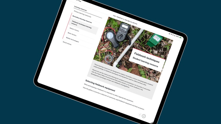
Fieldwork techniques
Help students prepare to use scientific equipment, sampling methods, observations and field data-recording techniques.
Location

School incursions
Planning information for incursions delivered at your school, including learning spaces, accessibility, risk management and staff access.
Extend student learning
Use these student-friendly fact sheets before or after your Geography fieldwork incursion to support ecological sampling, abiotic testing, water quality investigations and local geographical inquiry.
- Habitat fact sheet – Learn how living and non-living features create places where organisms can survive.
- Eucalypt forest ecosystem fact sheet – Use a forest example to support fieldwork about abiotic factors, vegetation structure and ecosystem interactions.
- Water habitats fact sheet – Explore aquatic habitats that can support water quality investigations near schools.
- River and creek environment fact sheet – Learn how waterways, banks, flow, plants, animals and human impacts are connected.
- Invertebrate fact sheets – Explore small animals that can be sampled, classified and used as fieldwork evidence.
- Urban environments fact sheet – Compare school grounds and local places with broader urban environmental systems.
Learn with us

Book this excursion
Book this Stage 6 Geography fieldwork incursion using our online booking form.
Supporting resources
Use secondary Geography learning resources to support ecological sampling, abiotic measurements, geographical inquiry and field-data analysis.
Related Stage 6 Geography programs
Earth’s natural systems excursion
Investigate atmospheric, hydrological, geomorphic and ecological systems through fieldwork in a forest ecosystem.
Place and cultural change excursion
Investigate migration, cultural identity and place change through fieldwork in a dynamic inner-Sydney urban location.